Detroit Flats
Home » Birding Locations » Marion County » Hwy 20 To The Cascades
Seasons
Checklists
Location
From the south end of the town of Detroit, turn off of Hwy 22 and go west on Santiam Avenue for 0.1 miles. Turn left (south) on Detroit Rd. S and drive south for 0.3 miles to the parking area. Detroit Road can be very birdy but has few turnouts so drive slowly and watch for birds flushing from the side of the road. Once in the parking area, take the trail for about 0.75 miles through scrubby vegetation. This can produce a nice volume of passerines and some good scope views of the lake.
Go to the Oregon Birding Trails Website. Choose the Cascades Birding Trail. Click on the Trail Guide and choose the Mt. Jefferson Loop Guide. Section 36.
DirectionsHabitat and Birds
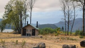
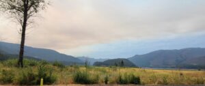
Open fields and brushy and marshy areas, with a few scattered trees along the bank of Detroit Lake. Much of the town of Detroit was destroyed by the 2020 wildfires, but it is rebuilding and is on the way to recovery. The most obvious change to the area is that most of the tall fir trees are gone. However, it appears that there is still plenty of good habitat for attracting birdlife to the area, especially spring migrants. Many eastern Oregon birds have been found here, including Gray Flycatcher, Sage Thrasher, Sagebrush Sparrow, Black-throated Sparrow and others.
Discussion